Distance
676.0 km
Duration
12h
Elevation Gain
6462m
Region
Norte Portugal
About This Route
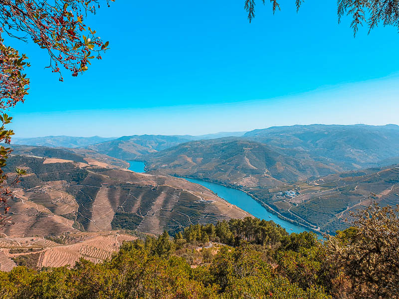
If Route 66 is the road of the American dream, National Road 2 is Portugal's answer: a line that crosses the country from north to south through the interior, from km 0 in Chaves to km 739 in Faro. It is the longest road in Portugal and one of the few in Europe that runs the full length of a country. The character of the road The N2 changes personality every hundred kilometres or so. In the north, the chains of bends in the Trás-os-Montes and Marão mountains lead to the Douro wine region, with terraces as far as the eye can see around Peso da Régua and Lamego. Then comes the Beira, with the Montemuro range, Viseu, the reservoirs and the schist villages around Góis and Lousã, where the tarmac wraps around the hills and the rivers cut through the landscape. After the Tagus, at Abrantes, the pace slows on the Alentejo plains, among cork oak woodland, straights that invite you to ease off the throttle and whitewashed villages. The finale is the Caldeirão range, already smelling of the Algarve, all the way to the marker in Faro.
Photos
Route Map
Share this route
Send it to your riding group or post it for your friends.
Recommended Stops
N2 marker | Km 0, Chaves
Landmark
Start of the N2 route, at Kilometre Zero in Chaves.
Vidago spa
Landmark
Spa park and the historic Vidago Palace. A good first coffee stop.
Pedras Salgadas spa park
Landmark
Park with sparkling-water springs, ideal for stretching your legs.
Vila Velha viewpoint, Vila Real
Viewpoint
View over the Corgo valley in the historic centre of Vila Real.
Peso da Régua and the Douro Museum
Landmark
Into the Douro wine region: the river, vineyard terraces and the Douro Museum.
Sanctuary of Nossa Senhora dos Remédios, Lamego
Landmark
Baroque stairway above Lamego, with views over the town.
Viseu Cathedral
Landmark
Viseu's historic centre, with the cathedral and the Grão Vasco Museum side by side.
Aguieira Dam
Viewpoint
Here the N2 lies under the reservoir; the detour is via the IP3 to Penacova.
Livraria do Mondego viewpoint, Penacova
Viewpoint
Rock formations above the Mondego river, near Penacova.
Ponte Real, Góis
Landmark
Old bridge over the Ceira river, with a river beach beside it.
Cabril Dam
Viewpoint
The road crosses the Zêzere next to the dam wall, between Pedrógão Grande and Pedrógão Pequeno.
Geodesic Centre of Portugal
Landmark
The marker of the centre of the country on Picoto da Melriça, with views all around. N2 passport stamp.
Abrantes Castle
Viewpoint
Viewpoint over the Tagus at the top of the town.
Ponte de Sor
Landmark
The N2 75th anniversary marker and the Arts and Culture Centre.
Montargil Dam
Viewpoint
A large Alentejo reservoir, with another N2 75th anniversary marker.
Km 500 marker, Ciborro
Landmark
The kilometre 500 marker of the N2.
Montemor-o-Novo Castle
Landmark
Castle ruins above the town, looking over the plain.
Calvário Chapel, Ferreira do Alentejo
Landmark
A round chapel, one of the most curious sights on the way.
Aljustrel
Landmark
Mining town with the Mining Park and the hermitage on the hilltop.
Almodôvar
Landmark
The last Alentejo town before the hills: medieval bridge and the Museum of South-Western Script.
Caldeirão hills
Viewpoint
The twistiest stretch of the N2: about 60 km of bends to São Brás de Alportel.
São Brás de Alportel
Landmark
Hill town at the gates of Faro, home to the N2 Memory House.
N2 marker | Km 738, Faro
Landmark
End of the N2 route, at the roundabout on the way into Faro.